


Naviator

Description of Naviator
<b>
This is a 30 day free trial of Naviator. Please see the "Subscription Information" section below for more details.
Notice: we do not provide customer support via Play Store reviews. Please contact our Support Team for customer support issues.<br/>
</br></b>
Naviator is a full-featured moving map GPS app for pilots. For less than the price of an hour of fuel you can have access to GPS navigation technology that would have cost thousands of dollars only a few years ago!
Quickly and easily share your flights with your friends on Naviator Hangar! (http://hangar.naviatorapp.com/)
<b>FEATURES:</b>
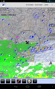
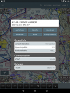
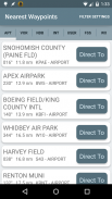
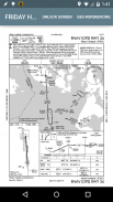
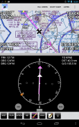
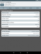
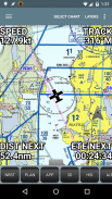
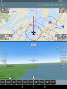
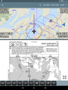
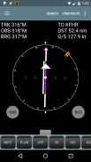
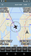
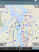
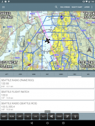
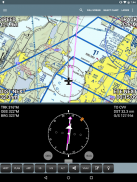
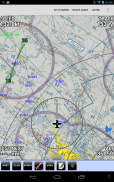
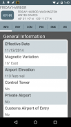
• GPS moving map with airspace, airports, radio navigation aids, airway intersections, TFRs
• All navigational data is downloaded to your device - no internet connection is required while you are flying
• Easy "rubber band" flight planning
• Support for ADS-B receivers including the <b>iLevil AW/SW</b>, <b>Dual XGPS 170 and XGPS 190</b>, <b>Navworx</b>, <b>SkyGuardTWX</b>, <b>Flight Data Systems Pathfinder</b>, <b>Stratux</b>, <b>FlightBox</b>, uAvionix pingBuddy and various receivers from <b>FreeFlight Systems</b>
• Integrates with ADS-B or the <b>Zaon XRX</b> for real-time traffic display
• <b>NEW!</b> AOPA members can import their stored routes from the AOPA Flight Planner
• <b>NEW!</b> Import custom airspace from OpenAir airspace files
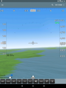
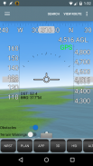
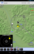
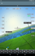
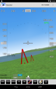
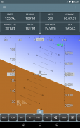
• 3D synthetic vision with terrain, obstacles/towers and runways
• Global terrain database with terrain warnings
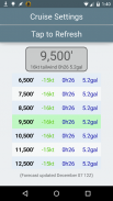
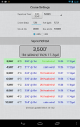
• Global Forecast Engine provides winds aloft anywhere on the planet up to 54,000 feet
• GPS track recording - upload your flight recordings to your own personalized Naviator Hangar (http://hangar.naviatorapp.com)
• Import routes from other flight planning systems using the GPX format
• Integrates with Microsoft Flight Simulator and Prepar3D
• Integrates with X-Plane using the "X-Plane to GPS" app (https://play.google.com/store/apps/details?id=com.appropel.xplanegps)
• Get a weather briefing and file a flight plan from right inside the app
• Vertical navigation (VNAV) calculator
• Canadian data including airspace, airports, navaids, terrain and weather
• NMEA output - Naviator can drive your aircraft's autopilot
• "Bring Your Own Charts" - you can import custom maps and charts into the app. See our forum for more details.
Our support forum is located at http://forum.naviatorapp.com/
<b>SUBSCRIPTION INFORMATION:</b>
Subscriptions provide access to all app, chart and data updates for the duration of the subscription.
<b>PRICING:</b>
Naviator is free of charge for the first 30 days of use. After this free trial period, the following items may be purchased:
(a) 30 Day Chart Subscription - $4.99 USD
Enables full app access for 30 days*
(b) 1 Year Chart Subscription - $34.99 USD
Enables full app access for one year*
(c) Unlock Naviator - $14.99 USD
Intended for pilots who do not fly in the United States, this one-time charge permanently unlocks all features of Naviator, except FAA approach plates, sectionals, TACs, IFR enroute charts, TFR updates and the "BYOC" feature.
<i>Includes database updates, weather updates, high-detail VFR base map, terrain database and 3D synthetic vision</i>
* geo-referenced approach plates require an optional subscription from Seattle Avionics. See our website for details.
</br></br>
</br>
</br>
</br>
</br>


